Please note: This list contains only german language titles
 |
Wunderlich, Thomas A. (Ed.)
Ingenieurvermessung 20Beiträge zum 19. Internationalen Ingenieurvermessungskurs München, 20202020, X, 502 pages, 170 x 240 mm, Broschur This book is also available as E-Book (PDF) |


|
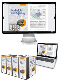 |
Becker; Blees; Deuster; Francke; Mietzsch; Nobis; Saary; Schwedes (Hrsg.)
HKV - Handbuch der kommunalen VerkehrsplanungStrategien, Konzepte, Maßnahmen für eine integrierte und nachhaltige Mobilität, Stand: 03/2025 (inkl. 101. Ergänzung)Loseblattwerk in 4 Ordnern/HKV Online - wird ca. 3 mal im Jahr aktualisiert 2025, 3852 pages, Loseblattwerk |
|
 |
Hinz, Stefan; Vögtle, Thomas; Wursthorn, Sven (Ed.)
Digitale Bildverarbeitung und GeoinformationDatenfusion unter geometrischen, physikalischen und semantischen Aspekten2019, 341 pages, 170 x 240 mm, Broschur This book is also available as E-Book (PDF) |


|
 |
con terra GmbH (Ed.)
FME DesktopDas deutschsprachige Handbuch für Einsteiger und Anwender2018, 442 pages, 170 x 240 mm, Broschur This book is also available as E-Book (PDF) |


|
 |
Herter, Michael; Mühlbauer, Karl-Heinz (Ed.)
Handbuch GeomarketingMärkte und Zielgruppen verstehen: Lokal. Global. Digital.2018, 462 pages, 170 x 240 mm, Festeinband This book is also available as E-Book (PDF) |


|
 |
Bauer, Manfred
Vermessung und Ortung mit SatellitenGlobales Navigationssatellitensystem (GNSS) und andere satellitengestützte Navigationssysteme2018, 566 pages, 170 x 240 mm, Broschur This book is also available as E-Book (PDF) |


|
 |
Seip, Christian; Korduan, Peter; Zehner, Marco L.
Web-GISGrundlagen, Anwendungen und Implementierungsbeispiele2017, 552 pages, 170 x 240 mm, Broschur This book is also available as E-Book (PDF) |


|
 |
Ulferts, Lothar
Python mit ArcGISEinstieg in die Automatisierung der Geoverarbeitung in ArcGIS2017, 336 pages, 170 x 240 mm, Broschur This book is also available as E-Book (PDF) |


|
 |
Coors, Volker; Andrae, Christine; Böhm, Karl-Heinz
3D-StadtmodelleKonzepte und Anwendungen mit CityGML2016, 503 pages, 170 x 240 mm, Broschur This book is also available as E-Book (PDF) |


|
 |
Möser, Michael
IngenieurbauHandbuch Ingenieurgeodäsie2016, 338 pages, 170 x 240 mm, Broschur This book is also available as E-Book (PDF) |


|
 |
Pomaska, Günter
Bildbasierte 3D-ModellierungVom digitalen Bild bis zum 3D-Druck2016, 252 pages, 170 x 240 mm, Broschur This book is also available as E-Book (PDF) |


|
 |
Hennig, Sabine (Ed.)
Online-Karten im FokusPraxisorientierte Entwicklung und Umsetzung2016, 351 pages, 170 x 240 mm, Broschur This book is also available as E-Book (PDF) |


|
 |
Mummenthey, Rolf-Dieter
ArcGIS Spatial AnalystGeoverarbeitung mit Rasterdaten2015, 218 pages, 170 x 240 mm, Broschur This book is also available as E-Book (PDF) |


|
 |
Scharold, Lothar; Peter, Roland
Immobilienwertermittlung unter Berücksichtigung demografischer EinflüsseEine Methodik aus der Praxis für die Praxis2014, XII, 107 pages, 170 x 240 mm, Broschur This book is also available as E-Book (PDF) |


|
 |
Kriegel, Otto; Herzfeld, Günter
Katasterkunde in EinzeldarstellungenHefte 1-132014, 1750 pages, 135 x 190 mm, DVD-Box, CD-Rom |

|
 |
Möser, Michael; Müller, Gerhard; Schlemmer, Harald (Ed.)
Heunecke, O.; Kuhlmann, H.; Welsch, W.; Eichhorn, A.; Neuner, H. Auswertung geodätischer ÜberwachungsmessungenHandbuch Ingenieurgeodäsie2013, XVI, 688 pages, 170 x 240 mm, Broschur This book is also available as E-Book (PDF) |


|
 |
Andrae, Christine; Fitzke, Jens; Zipf, Alexander (Ed.)
Andrae, Christine Simple FeaturesPraxisnahe Standards für einfache Geoobjekte in Datenbanken und GISOpenGIS essentials – Die Geo-Standards von OGC und ISO im Überblick 2013, 240 pages, 170 x 240 mm, Broschur This book is also available as E-Book (PDF) |


|
 |
Klärle, Martina (Ed.)
Erneuerbare Energienunterstützt durch GIS und Landmanagement2012, XX, 428 pages, 170 x 240 mm, Broschur This book is also available as E-Book (PDF) |


|
 |
Bill, Ralf (Ed.)
Virtuelle Forschungsumgebung für die Kulturlandschaftsforschungauf Basis von Internet-GIS-Technologien2012, VIII, 186 pages, 170 x 240 mm, Broschur This book is available as E-Book (PDF) |

|
 |
Möser, Michael; Müller, Gerhard; Schlemmer, Harald (Ed.)
Möser, M; Hoffmeister, H.; Müller, G.; Staiger, R.; Schlemmer, H.; Wanninger, L. GrundlagenHandbuch Ingenieurgeodäsie2012, XII, 628 pages, 170 x 240 mm, Broschur This book is also available as E-Book (PDF) |


|

